We Could Be Witnessing the Death of a Tectonic Plate, Says Earth Scientist

A gaping hole in a dying tectonic plate beneath the ocean along the West Coast of the United States may be wreaking havoc at Earth’s surface, but not in a way most people might expect.
This gash is so big it may trigger earthquakes off the coast of Northern California and could explain why central Oregon has volcanoes, a new study found.
The researchers in the new study aren’t the first to suggest that the Michigan-size Juan de Fuca (pronounced “wahn de fyoo-kuh”) plate has a tear. But thanks to a new, detailed dataset, they’re the first to say so with certainty. [The Science of Plate Tectonics and Continental Drift (Infographic)]
“Where other people had debated whether or not it [the tear] was there, we can pretty confidently say that it’s real,” study lead researcher William Hawley, a doctoral student in the Earth and Planetary Science Department at the University of California, Berkeley, told Live Science.
The Juan de Fuca plate is long, stretching about 600 miles (1,000 kilometers) along the Pacific Northwest coast, from Vancouver Island, Canada, to Cape Mendocino, California. “No part of it is above the water. It’s a total oceanic plate” that’s subducting, or diving beneath another plate, in this case the North American plate (a continental plate), Hawley said.
From 2011 to 2015, scientists boated out over different parts of the Juan de Fuca plate, dropped ocean-bottom seismometers underwater and let these sensors collect seismic data from earthquakes all over the world for a year.
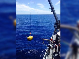
When the year was up, the researchers returned, fished up the seismometers and uploaded the data, which allowed them to create a tomography, or layout, of the plate. Then, they deployed the devices to other spots on the plate. “It was an enormous community effort,” Hawley said.
The data from these seismometers showed how seismic waves traveled through the plate, which, in turn, revealed information about the plate’s composition and varying temperatures. One region under central Oregon showed a gap in high-velocity seismic waves, which Hawley interpreted to be the hole.
But why does this hole exist? Hawley and study co-researcher Richard Allen, director of the Berkeley Seismological Laboratory, hypothesized that there is a weak zone in the Juan de Fuca plate that exists because the plate formed at two overlapping ridge segments. As this weakened zone of the oceanic plate goes under the continental plate, it unzips from the bottom up (from the underside upward), creating a gash.
“This tearing may eventually cause the plate to fragment, and what is left of the small pieces of the plate will attach to other plates nearby,” the researchers wrote in the study. In other words, “we’re witnessing the death of a plate,” but it will take at least a few million years to die, Hawley said.
Hawley and Allen estimated that the hole is located at a depth of between 155 and 60 miles (250 and 100 km). The tear itself, which is narrower on top and widens with depth, is about 120 miles (200 km) wide. [Hidden Undersea Mountains Uncovered with Satellites (Photos)]
Moreover, it appears that material is getting pushed up through the tear, which may have led to the formation of the volcanoes in central Oregon’s High Lava Plains about 17 million years ago, Hawley noted. In fact, it’s incredible how many geographical and seismic features in the Pacific Northwest fit into the researchers’ hypothesis, he said.
“The story links the hole in the tomography with this known weak zone in a plate and with a series of volcanic centers in Oregon and with a series of earthquakes and faults off the coast of Northern California,” Hawley said.
The research is a “thought-provoking idea paper,” said Ray Wells, a research geologist emeritus with the U.S. Geological Survey in Portland, Oregon, who was not involved with the study.
“I’m happy to see more data indicating a hole in the Juan de Fuca plate,” Wells told Live Science in an email. “The coincidence of the hole with the location of a subducted zone of weakness in the Juan de Fuca plate is interesting and could help to produce a tear.”
The study was published online July 11 in the journal Geophysical Research Letters.
PRINCIPIA SCIENTIFIC INTERNATIONAL, legally registered in the UK as a company ![]() incorporated for charitable purposes. Head Office: 27 Old Gloucester Street, London WC1N 3AX.
incorporated for charitable purposes. Head Office: 27 Old Gloucester Street, London WC1N 3AX.
Please DONATE TODAY To Help Our Non-Profit Mission To Defend The Scientific Method.
Trackback from your site.
jerry krause
| #
Hi Laura and PSI readers,
It is amazing how actual science based upon actual observations generate few immediate comments. Maybe I should wait to see if anyone else makes a comment but I am very familiar of the volcanic activity that has occurred in south Central Oregon. For I own 20 acres of this volcanic activity about 10 miles North of Bly OR.
Part of this volcanic activity is a sheer 20-30 foot lava rim rock which begins about 50 yards to the north of our cabin and 50 feet from our cabin and this sheer rim rook extends about 2 miles to the south. Gearhart Mtn, clearly a volcanic mountian is about
15 miles to the east. And I have read that it is not part of the Cascade range formed by volcanic mountain after volcanic mountain.
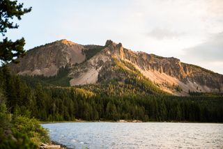
30 to 50 miles to the east is a geological feature known as the Abert Rim, Might be considered similar to the last photo, or even a portion of it. I do not know whether the high rocks at the top were uplifted, or if the surface of the land of the lake subsided. But I am sure when this activity, which had nothing directly to do with any volcano. This activity, I image, had to be the direct result of the movement of the plates (‘tear’) referred to in the article. And I expect when this was occurring there were significant earthquakes.
On our property ponderosa pine grow in the ash, which soaks up any precipitation like a sponge, west of the sheer rimrock. Above the rimrock immediately to the east the soil is such that it absorbs no precipitation. And this ground, in places, is covered with ‘head’ sized volcanic stones so one can walk from one stone to another. To me, the only reasonable explanation for the stones and ash is the violent eruption of Gearhart which blew its top like that where Crater Lake now is and Mt St. Helen did during my life time.
“Moreover, it appears that material is getting pushed up through the tear, which may have led to the formation of the volcanoes in central Oregon’s High Lava Plains about 17 million years ago, Hawley noted.”
I doubt if the eruption of Gearhart occurred “about 17 million years ago”. Clearly there is evidence that some pine trees have been logged since, say, 1850, and that most of the pines growing on my property have grown since that time. But there are two much older, much bigger pines growing at the top of the rim rock, where there is no ash and these trees are not easily accessible. And I doubt if one fell them, one would find they are only a couple of hundred years old.
When Mt St. Helen blew its top, the surrounding trees were blown over for a considerable area. Hence, I conclude that the same thing happened when Gearhart violently erupted.
Without your article and PSI I first learned of this science based upon observation, and maybe William Hawley, a graduate student, should take a hike up Gearhart Mtn and observe it and the surrounding ‘cinder cones’ which might be seen in this volcanic region which is not considered to be part of the Cascade range.
Laura, hope you will inform William of my comment and I might try to also contact him.
Have a good day, Jerry
Reply
tom0mason
| #
“We Could Be Witnessing the Death of a Tectonic Plate, Says Earth Scientist ”
Hey, kids another extinction event!
🙂
Reply
jerry krause
| #
Hi Readers,
Been a week now and no other serious comment about William’s excellent scholarship based on data. Sorry, Tom0mason, your comment only mocks the efforts of William Hawley and Richard Allen to better understand the earth’s natural volcanic activity. Which random activity can in no way can be construed to be influenced by human activities.
Read Robert Beatty’s excellent scholarship (https://bosmin.com//SeaChange.pdf) to see how this volcanic activity may have influenced climatic in the past and possibly now in the present.
Have a good day, Jerry
Reply